What is the proper status and character to give the boundary separating the South Campus from the agricultural expanse of the Saclay Plateau? How should this “third space” be conceived, a space which should bring together a large diversity of functions? How should its evolution, management, and enhancement be organized, a process necessarily distributed between multiple actors, as well as one utilizing a diverse number of economic models and approaches, both commercial and collaborative?
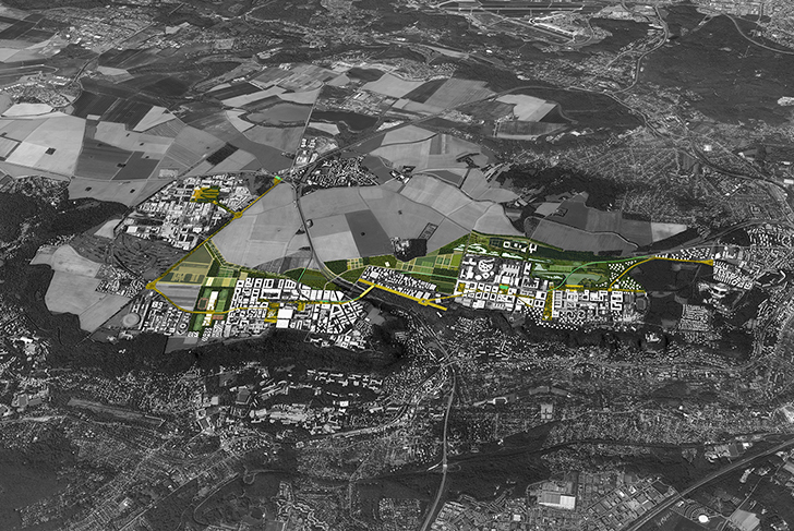
These questions are among the most passionate concerning the development project. The edge area proves to be one of the most structuring elements of the Paris-Saclay project. The project is emblematic in its concretization of an idea all the more meaningful in contemporary society: that of the powerful recomposition of peri-urban territories. The project site here becomes a magnificent laboratory for approaching the challenges involved in spatial transition, an area of investigation which relates in reality to a multitude of other contexts. A position and awareness that constitutes as well one of our major contributions to the team led by Jean Nouvel for the international consultation regarding the Grand Paris project in 2009.
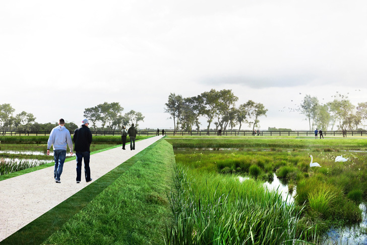
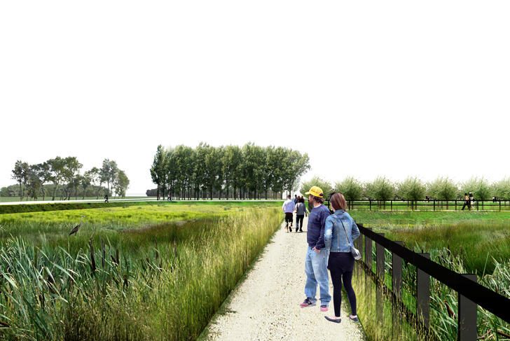
The edge of the South Campus is not a simple line, a demarcation boundary line embodying a temporary stabilization of the urban expanse. The edge area here widens and enriches itself until becoming the place where the reconciliation between two long opposed worlds, the city and the countryside, can take place again.
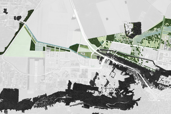
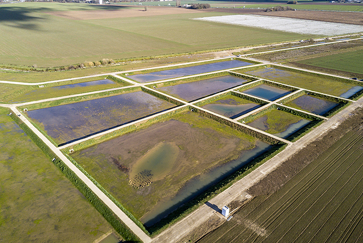
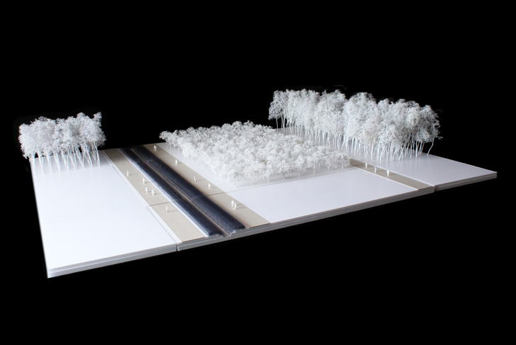
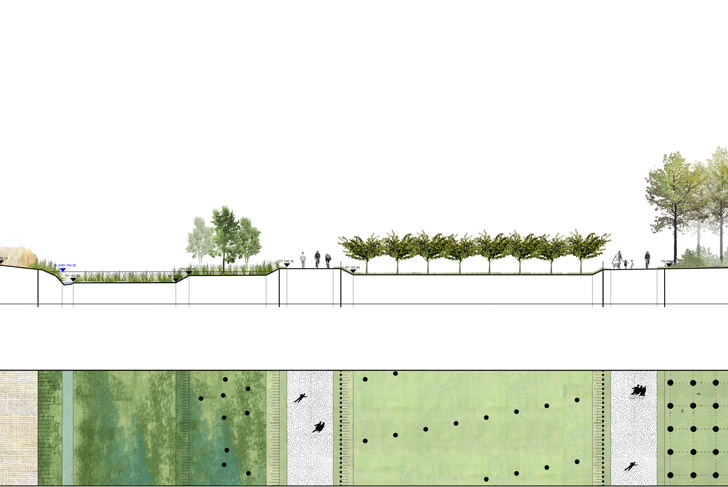
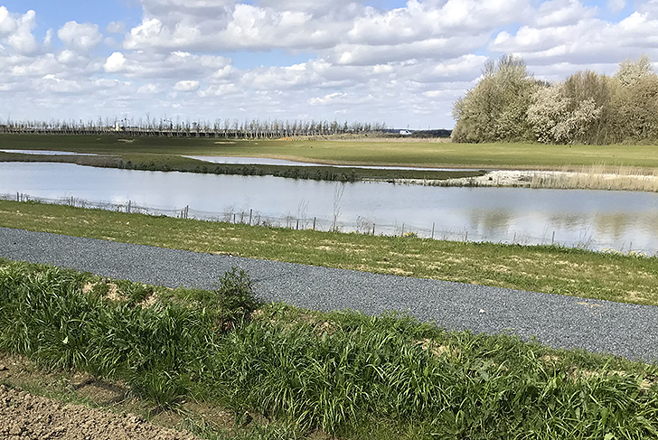
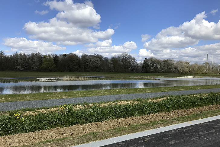
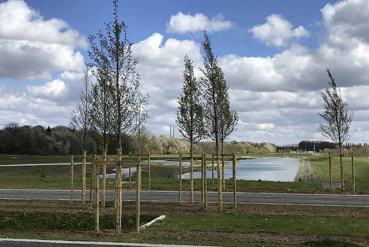
The northern edge of the campus-park represents a surface area of around five hundred hectares, which is more than double the area of the constructed blocks. This edge is made up out of already existent landscape spaces, such as the Palaiseau public forest, the Bois (woods) of Normandie and Vaulhallan, as well as new landscape entities. Despite providing a landscape structure of marked continuity, the area is a composite landscape, a collection of contiguous spatial entities made up of varying sizes, typologies, functions, and means of being managed. The edge area follows consistently as well upon the chain of major campus spaces, helping define the scale of the compact neighborhoods. Its flexibility allows also for the integration of atypical elements, both those already existing and those to come, including the buildings the most distantly located from the heart of the campus, buildings whose sizes and themes vary greatly. The components that make it up can be classified into two principal landscape categories:
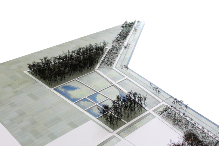
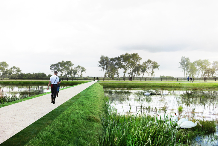
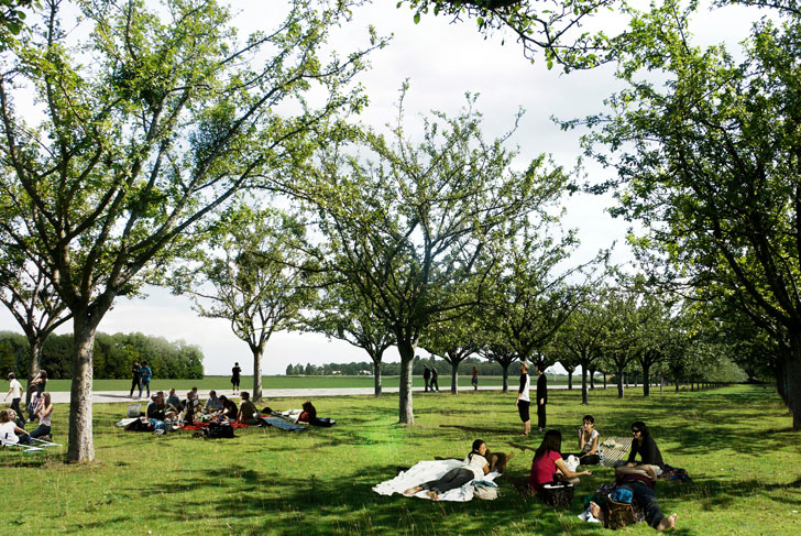
- the naturalistic landscape, which relies on the surrounding wooded structures to continue it. Taking into account the composition of the forested site in such a way that the constructions that make it up combine into a landscape of meadows, basins, and large groves of trees. The forest appears enhanced, fully accessible. It forms in its turn a continuation of the inhabited spaces. Spacious clearings welcome large sporting grounds as well as built complexes.
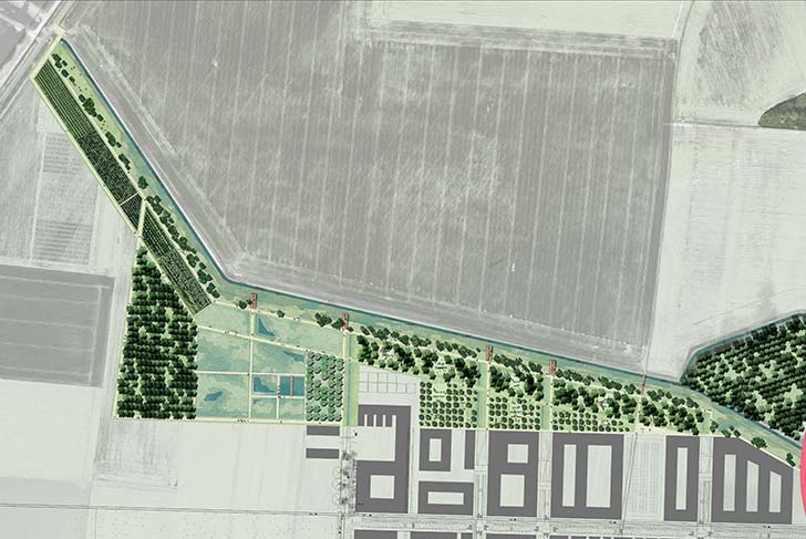
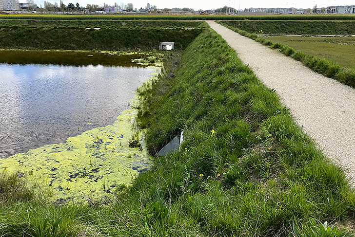
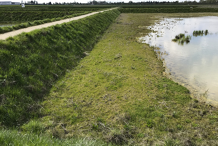
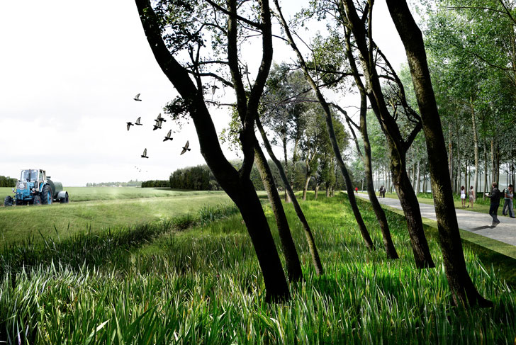
- the intermediate landscape, which is located at the hinge between the large agricultural fields of the surrounding plateau and the heart of the city-like campus. The proposal gives quality to the site without completely altering it. The focus lies in shaping the land with economic means, not orienting it towards the idea of establishing a nature to simply contemplate, but rather towards the creation of a space in which practices, activities, and exchanges can take place. The intermediate landscape is a small, domestic piece of countryside. Within a space today fragmented and experienced for the most part by car, it reconstructs a scale appropriate to the pedestrian. It can be easily strolled, facilitating connections by foot or bicycle between the towns of the plateau and the valley.
Through integrating the territory's uses in its design, chief among them being agriculture, the project establishes all its relevance. As a result, it includes an agricultural dimension adapted to the urban context of the campus. The use of techniques and methods borrowed from the sphere of agriculture allows as well for the meeting of many technical requirements, such as the storage of topsoils, materials, and water, the establishment of nurseries, and the setting up of an ecological engineering capable of contributing to the transformation of the site. Its evolving character makes of the edge area a living and inhabited landscape.
The edge project has come to characterize the urban project, being both setting and address. At the metropolitan scale of Greater Paris, for users and residents as well as for visitors, it participates in the composition of a neighborhood's identity and attractiveness.
Etablissement public d'aménagement Paris-Saclay (EPAPS)
MDP Michel Desvigne Paysagiste (lead consultant)
Artelia
Confluences
170 ha (420 acres)