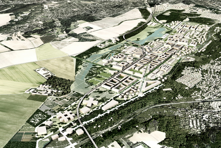
The planning and design of the École polytechnique neighborhood marks a major phase of the development of South Campus on the heights of the Saclay plateau. The history of this site began in the 1970s, when the École polytechnique was moved from Montagne Sainte-Geneviève in Paris to this vast 160 hectare campus designed by Henri Pottier. The original autonomy of the architectural whole was symbolized by a boulevard that encircled the site, keeping it at a distance for many years from the nearby urbanized valley. Over the course of decades, successive transplantations onto the site have rendered the campus so illegible and incomprehensible that it has become a challenge finding the entrance.
Today, the campus is set to become the heart of a much more expansive whole, a vast campus with considerable renovations in terms of infrastructure and public spaces. The area to be redeveloped spreads out to a perimeter of two hundred thirty-two hectares. With the planned arrival on site on many new stakeholders (the ENSAE, the Institut Mines-Télécom, AgroParisTech-INRA, EDF Lab, and EDF campus), along with the introduction of the Express bus and line 18 of the Greater Paris metro, a redevelopment plan that can no longer be satisfied with the state logics of the past has been initiated.
The task of this transformation project has therefore become multiple: open up the École polytechnique site so that its qualities are highlighted; foster the birth of a vibrant and mixed neighborhood; link the new neighborhood together; impart a greater amount of sense and readability to the public spaces. The landscape constitutes a significant asset, offering a physical framework that allows this gradual transformation to come about in a coherent manner.
To the north, a naturalistic landscape
A naturalistic landscape to the north of the site allows for the integration of the very large research centers, either already existing or planned, into the heart of a coherent landscape and a new road network. The boulevards that run around these large estates are redeveloped, while the squares are reconfigured so as to open up onto the transformed public space.
The landscape includes large basins as well as other ecological works necessary for the proper functioning of the neighborhood. In fact, the combination of urbanization and the very low permeability of the Saclay plateau ground require the creation of sizeable rainwater storage volumes, which allow for water to be rereleased gradually through low flow channels. These basins are assembled in succession, supplementing and extending the existing lake. The entirety, including a series of pathways, has been designed for transformation into a public park.
The landscape includes an ecological corridor connected to the north at the level of the hydro-ecological arrangements, and to the south at the Corbeville canal. Punctuated throughout with ponds, damp fields, wetlands, as well as groves and hedges, the corridor allows protected species to cross the agricultural lands of the Saclay plateau without trouble, reaching the wooded hillsides and canal to the south.
To the east of the École polytechnique's lake, the landscape can welcome a residential neighborhood. Extending the atmosphere present in the clearings of the Palaiseau woods will provide a unique setting for living.
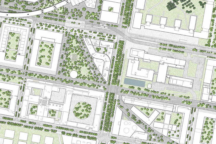
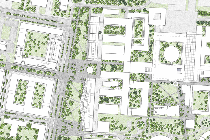
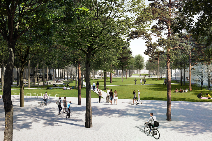
The “central strip”, heart of the campus
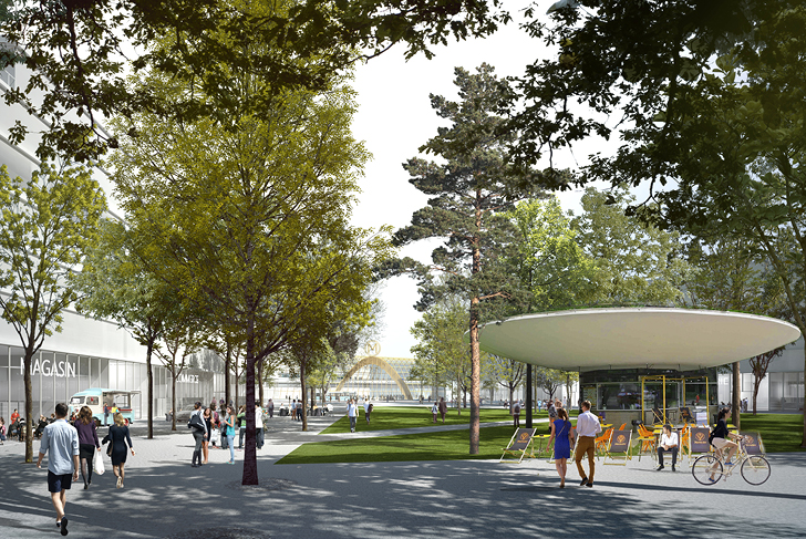
The neighborhood will be organized around the creation of a central strip, which will function as the heart of the campus, welcoming housing, economic activities, higher education and research institutions. This central axis bordered by two boulevards will be covered with a succession of public spaces, becoming large squares in front of university sites, smaller courtyards in front of businesses, public gardens in front of residential buildings. In the center of the neighborhood, the line 18 Palaiseau metro station will form the spot of activity and appeal for the neighborhood.
A readable and fixed pattern of extensively planted north-south streets ensures the smooth flow of traffic. A major central axis is principally dedicated to soft forms of traffic. The landscape present here in the heart of campus fits smoothly into the continuity of the wider landscape present along the “chain of major places” that runs across the entirety of South Campus. The usual typologies of public spaces utilized in city centers cannot be of reference here. It is necessary to avoid the urban stereotypes in which parks and gardens on one hand, the streets and squares on the other, are established as so many separate elements. The focus is rather on the composition of space using mixed typologies, modeled after the form of American campuses. The place within the campus-park where activity is the most concentrated becomes a comfortable urban development with a highly pronounced landscape dimension.
Being aware of the time necessary for the construction of the neighborhood as well as of the diversity in its architectural makeup, the endeavor to create a continuity and a consistency in its exterior spaces becomes essential. A unified treatment of the ground creates a foundational support and setting for the neighborhood. Its implementation relies on an atypical economy of means. Perhaps here more than elsewhere, the reality of the construction work and its maintenance are a determining factor in the readability of the whole. The issue is approached concretely with the creation in 2013 of an original space where a kind of prefiguration can take place, the “test garden”.
Etablissement public d'aménagement Paris-Saclay (EPAPS)
MDP Michel Desvigne Paysagiste (lead consultant)
Xaveer de Geyter, Floris Alkemade, Architects-urban planners
Arep
Ingerop
Sogreah
Setec
Alto
Tractebel
Sol paysage
Confluences
230 ha (568 acres)