Recreating the landscape of the Parc Régional de Camargue nature park
A design driven by water
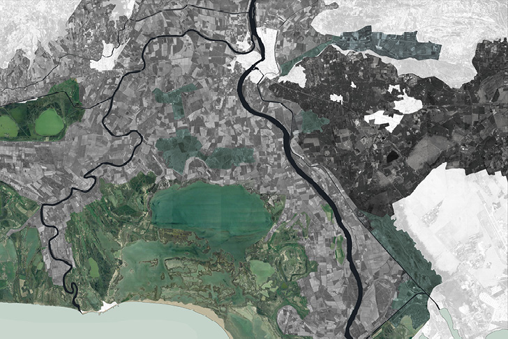
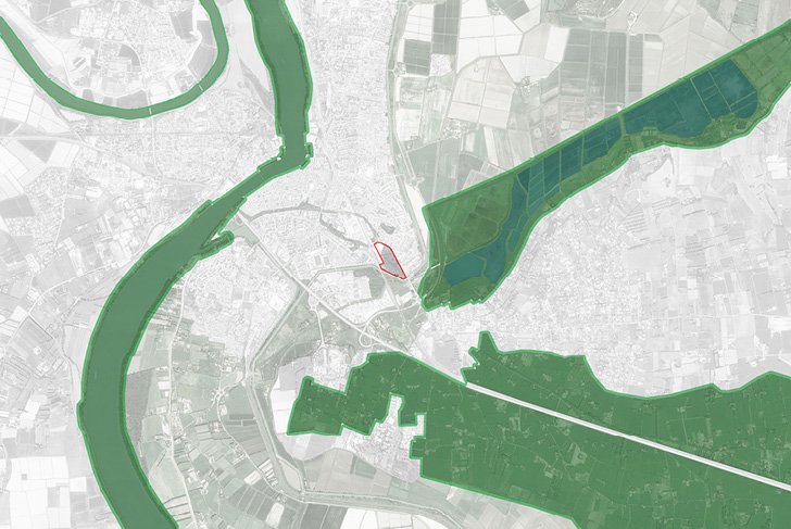
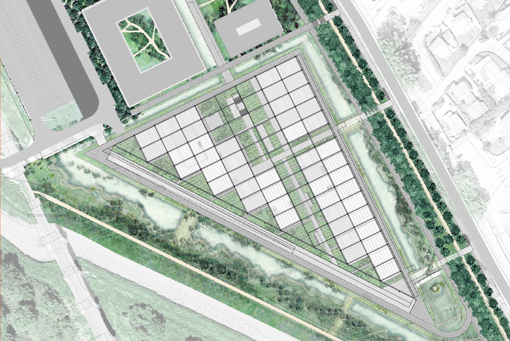
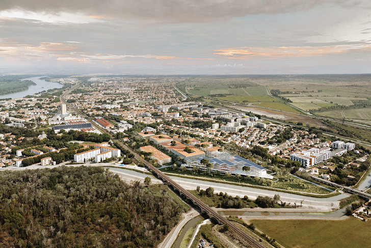
The Minimes site is a 6-hectare plot of abandoned farmland, where the city meets the vast surrounding landscape of the Parc Régional de Camargue nature park. This urban fringe area sits at the heart of a fragmented and patchwork urban fabric, hemmed in by infrastructural perimeters: SNCF high-speed train tracks, the Crau aqueduct, and the Canal de Viguerait canal.
Our project transforms these linear, infrastructural perimeters from spatial constraints into new, regional landscape corridors. The project reimagines the relationship between city and water, turning this budding neighborhood into a model for climate resilience by decreasing impermeable surface area and using water as the building block of urban design.
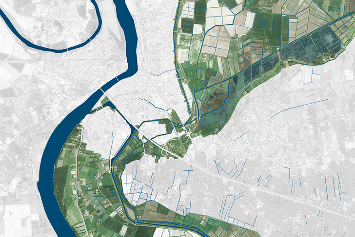
The Minimes site has historically been part of the hydraulic system for the marshlands of the city of Arles. The Marais de Beauchamp marsh (Natura 2000 site) is filled with freshwater wetland habitats, including reed beds, temporary ponds, tidal marshes, and riparian zones. Natural and agricultural geographic features of the Camargue region are scaled and recreated in the new neighborhood. The resulting landscape highlights the ecosystem of water-friendly plants.
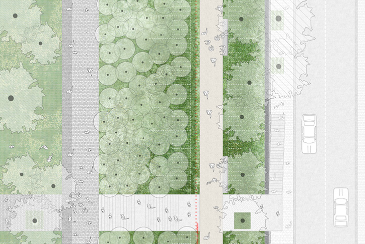
The project site sits at the meeting point of two existing, linked, and complementary environments. One is uniform, filled with rows of trees that run along surrounding infrastructure; the other is wilder, bursting with wooded bands that mark marshy areas. These two environments are recreated at the Minimes site across four landscape elements, developing a landscape identity deeply rooted in the fabric of the city and its natural surroundings.
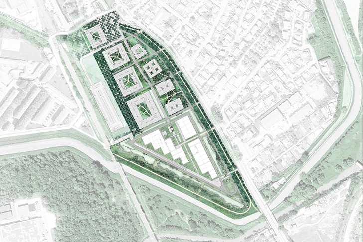
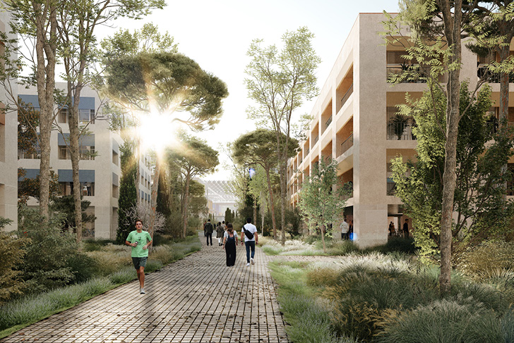
The tree-lined walkway, designed in the style of planted spaces in the South of France, reduces noise pollution from the high-speed rail line and connects public spaces with traffic flow. The meticulous network of trees (oak, hackberry, walnut, etc.) is enriched by the understory of planted tree beds (rockrose, euphorbias, etc.). Visitors can stroll throughout the neighborhood along a grid of alleyways bordered with long steel pools.
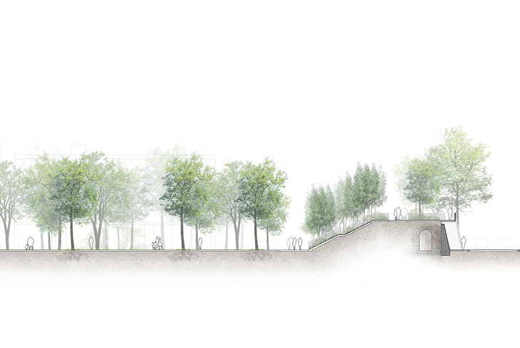
The high promenade extends the square before the former leprosarium all the way to the top of the Craponne viaduct. Riparian vegetation lines the entire walkway.
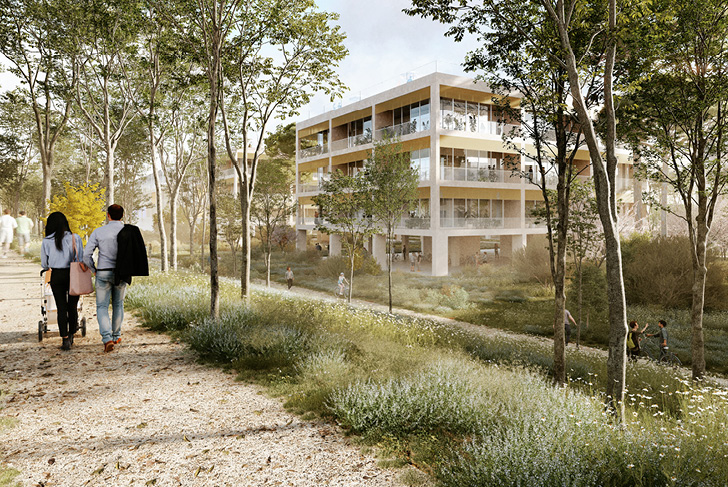
The “romantic forum” features an open park and a romantic promenade that connect the square before the former leprosarium to the Cité de l’Image museum at the southern end of the project site. The forest-like landscape brims with the lush canopies of large trees (alder, oak, elm, etc.) and vibrant undergrowth, all in a simple layout. The ground is living and permeable. Areas of planted softscape are slightly lower than surrounding ground level, engineered to collect, slow, and absorb rainwater.
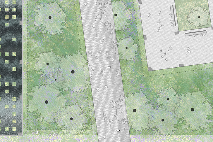
The large meadow is a scaled version of the local landscape, recreated to fill the Cité de l’Image museum grounds. This dry meadow landscape, “floating” and horizontal, highlights the clean lines of the building. Along the southern edge of the site, a new shallow pool cultivates a wetland landscape typical of the Camargue region, filled with large reed beds and small, scattered groves. This wetland optimizes rainwater management throughout the project site.
Nexity villes et projets
RSHP, GRAU, MDP (Michel Desvignes Paysagistes), NGA (Neufville Gayet Architectes)
16ha