Two major public spaces on either side of the Garonne
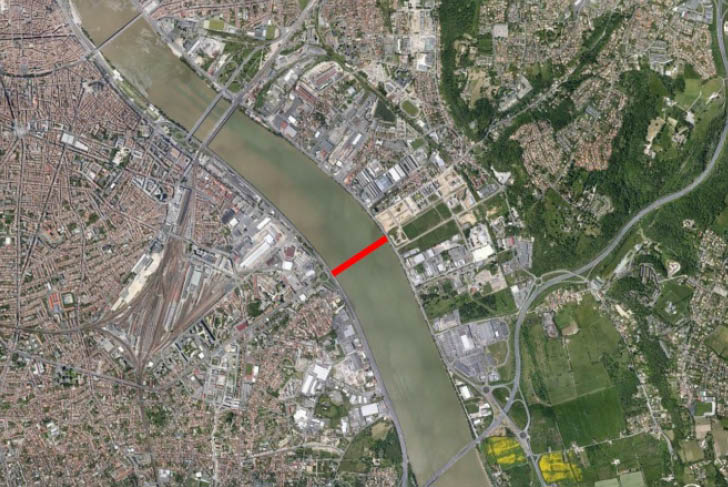
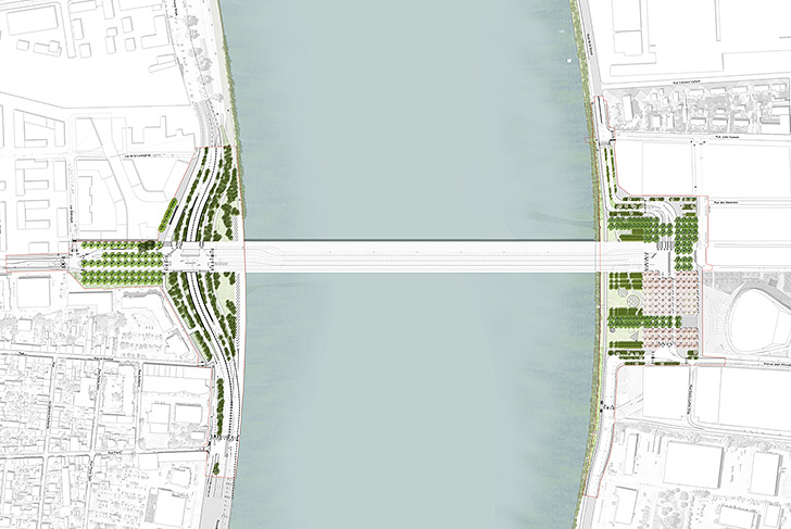
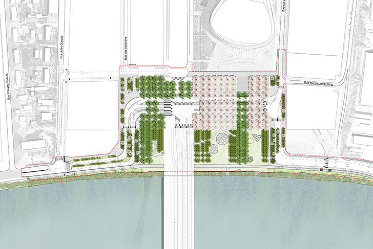
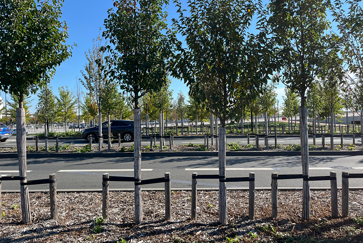
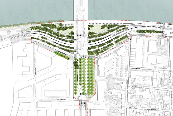
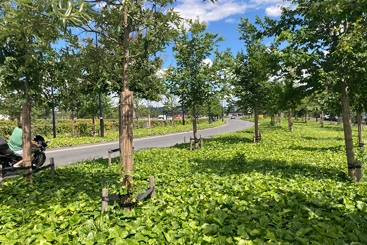
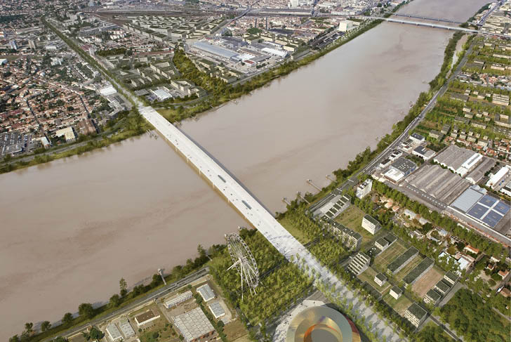
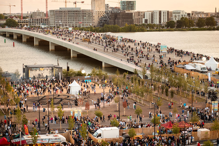
After the commissioning of the Jacques Chaban-Delmas Bridge to the north, the Simone Veil Bridge to the south will complete the loop of boulevards connecting Bordeaux's two banks. At the waterfront, the bridge rests significantly set back from the river, establishing two major public spaces on each side as a result, where river meets city. The project takes advantage of the palpable and well-known difference between the two banks: the rural aspect of the right bank is expressed through a landscape making strong use of the geometries associated with agriculture, while the urban character of the left bank is expressed through a more naturalistic landscape modeled after a number of Bordeaux's parks. On the right bank, a large poplar grove made up of very tall trees with bare trunks, provides a significant amount of visual transparency while creating large spaces for urban uses. In a perpendicular pattern in continuation of the Park aux Angéliques we have been developing along the river since 2008, the poplar grove runs alongside roads, bicycle paths, and footpaths. On the left bank, a park similar to those found in the city is made up out of a series of groves arranged in a very naturalistic manner. The restoration of the Garonne's natural riverfront allows the walking area to be extended all the way to the bridge and beyond, bringing into relief and firming up this ecological corridor of the left bank. Along Jean-Jacques Bosc Boulevard, alignments of large trees announce the arrival of the bridge, forming an urban square in which transition takes place, with bridge becoming boulevard
Communauté urbaine de Bordeaux (CUB)
MDP / OMA, Architecte (lead consultant) / WSP groupe EGIS, engineers / Lumières Studio
4 ha (10 acres)