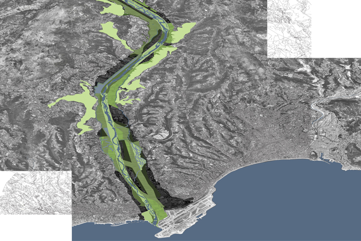
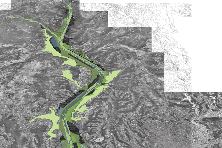
The transformation of the landscape of the Var Plain is a necessary prerequisite to any urban project for the area. Creating a unique and unified landscape capable of bestowing upon this territory upstream from the coast an identity as strong as that shared by the coastline and its surrounding hills, is of first importance.
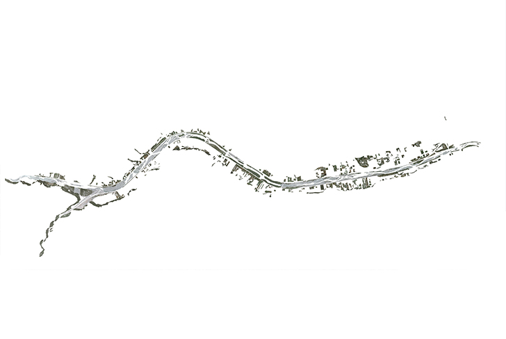
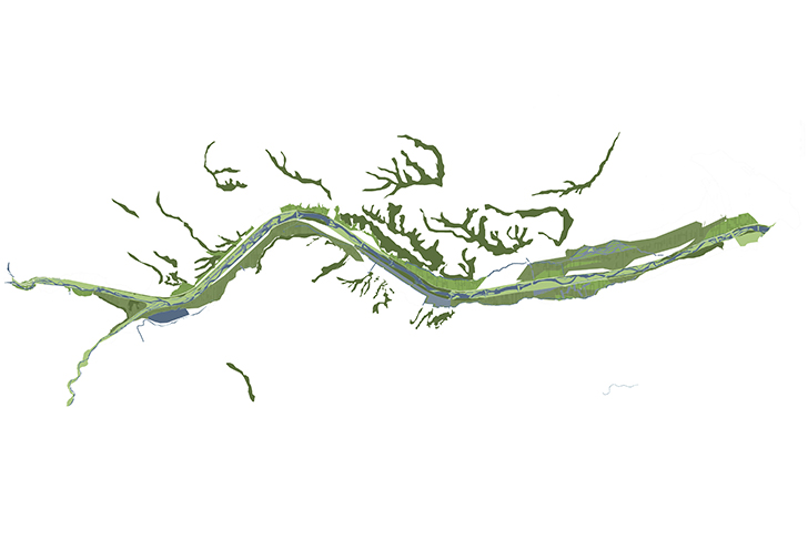
The large infrastructure network of dikes, and the traces of agricultural practices which have left their mark on the landscape, show us that only powerful transformations, along with curiously a certain artifice, are capable of bringing this valley back to life. It would be a mistake to pretend that a pseudo-natural environment, long since vanished, could be restored to the area. Rather, in seeking to create a new landscape that will reinvigorate and highlight the qualities of the plain, the concept of “embellishment” is our preferred point of reference. The aim is to establish a reinterpreted presence of “nature”, artificial but above all spectacular and powerful.
The project focuses on conceiving of the territory within one vast geographical vision, in which the flowing and dimensions of the river, along with its alluvial valleys, are rendered perceptible and felt anew. The project takes into account the existing forms, both natural and manmade, both those left abandoned or already completed, while seeking to incorporate into its conception the territory's hydraulic movements, the topography closely linked with water flows.
The dikes in particular are preserved, on either side of which constructible urban pocket areas are identified, which incorporate already existing housing. The strategy of transposing natural elements ends up in creating another reality, whose form and size are significant and reassuring, and which succeeds in imparting sense and meaning to the void of empty space. In forming densely built urban pockets, positioned in “quay-like situations” as a result of the site's configuration, it is indeed possible to give an image to the territory that everyone can recognize and understand. This process creates a physical and coherent identity for the whole territory, while taking into account the old infrastructure network for eminently urban uses.
Communauté d’agglomération Nice Côte d’Azur
MDP Michel Desvigne Paysagiste
OMA
XDGA, Xaveer De Geyter Architects
1820 ha (4497 acres)